- Difficulty: Difficult
- Best Seasons: Mid to late summer
- Fees: None
- Google Map
I once dubbed Crystal Lake Trail the “Knee Breaker” because both of my hiking partners on two different occasions had to turn back due to knee pain. So this time, I went alone and I was determined to reach Crystal Lake!
The Crystal Lake Trailhead is at the Wildhorse Lake Campground in the Gospel-Hump Wilderness. For a point of reference, it’s about a 2 hour drive from Grangeville, Idaho. Just head east on Highway 14 towards Elk City, but before you get there, take a right on Crooked River Road and head south. You’ll make your way through the little community of Orogrande before climbing up and over Orogrande Summit and then across to Wildhorse Lake.
Take a good 4-wheel or all-wheel drive vehicle with high clearance because the roads around Wildhorse Lake are more like dry riverbeds with large, exposed rocks threatening to puncture your tires and tear up the underside of your rig. I’ve done the drive in a Mercury Mountaineer and a Subaru Outback. Both made it fine, but I took it a lot easier in the Outback because I knew my spare was just a donut that probably wouldn’t get me back down the hill. Be prudent. Be prepared. Especially if you plan to go past Wildhorse Lake and drive up to Hump Lake. A flat tire out here would be no joke.
I hit the trail at about 10 AM under a cloudless sky in July at 7500 feet elevation wearing a tank top and no sunscreen like a total noob. I was going to pay for that, but there was no turning back now.
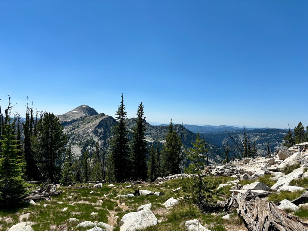
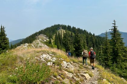
I really enjoy the first two miles of this trail, even though it is a steady climb from 7500 feet to 8800 feet at the top of North Pole peak. The trail starts off flat in the shade of the trees, passes through a marshy meadow, and then begins to climb up a well maintained switch-back trail with wide-open views of the mountains to the south. It’s challenging, for sure, but it’s fun.
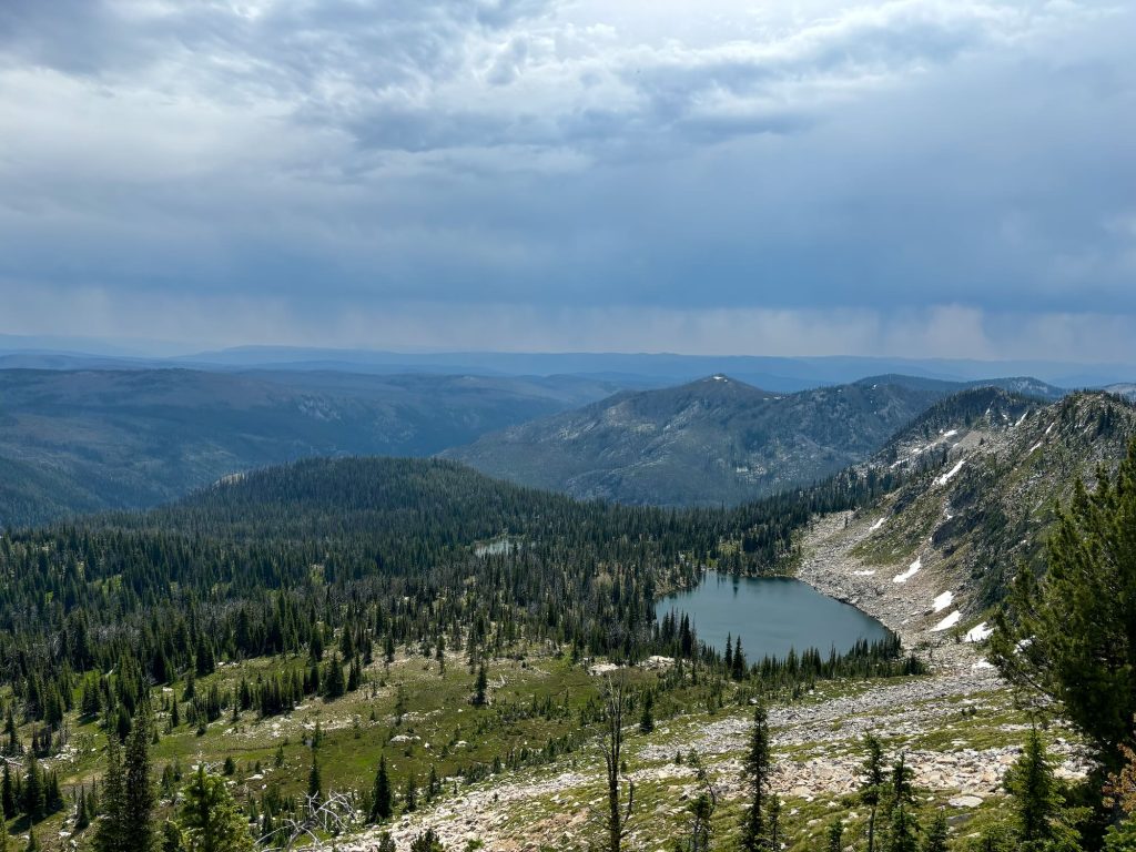
The trail curves around the rim of the bowl overlooking the Kelly Lakes and cuts across the face of North Pole (with an optional side trail to the summit) before dropping down the west side of the ridge towards Wiseboy Creek.
That ridge is a threshold of sorts for me. I call it Knee Breaker Ridge! That’s as far as I made it on my first two attempts at this trail, and apparently, it’s also as far as any trail crew has made it in years.
The way down is still in fairly good condition with only a few fallen trees in the way. Shortly after the trail levels out, it passes by a campsite in the trees before rising up to an old mining worksite. Here, splintered planks of long-forgotten buildings are scattered about the remains of large metal machinery crafted once upon a time by Union Iron Works in Erie, Pennsylvania.
Not far past the mining equipment, the trail disappears beneath a veritable blanket of fallen trees. And the ground is completely saturated with water. I kept trying find high ground, but only found more fallen trees. I stepped off a branch right into a hidden stream of water. I straddled logs trying to navigate by Gaia Maps, swatting at swarms of flies and mosquitos. The only thing that freed me from the marshy field of fallen timber was the steep incline of the next ridge I had to climb over. But it was no relief from the mosquitos.
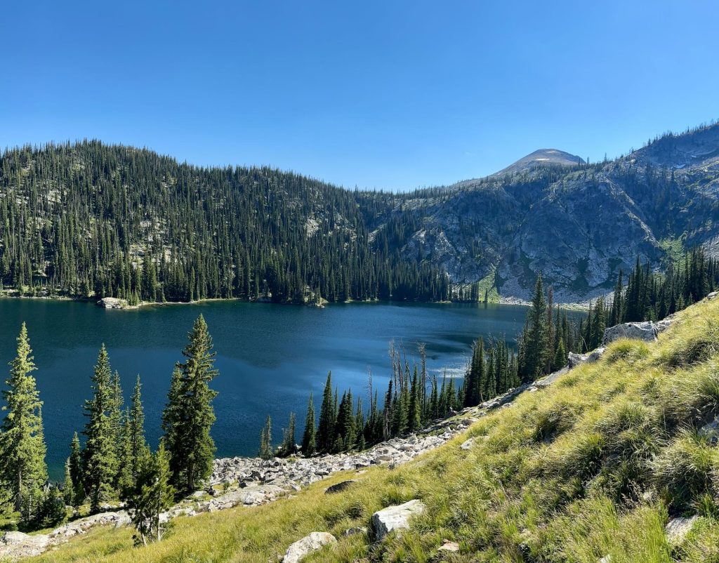
Eventually, I crested the ridge and got my first look at Crystal Lake. It was beautiful. I savored that view, knowing that I may never see the lake from this side again. If I ever return, I’ll probably drive up to Hump Lake and hike the mile down to Crystal Lake, and there won’t be any need to stand here on this ridge again.
A dam of rocks and logs blocks the outlet of the lake and an old, rusted pipe is mostly buried in the outgoing creek bed. I followed the creek and piping to a small set of waterfalls downstream. After a few photos, I decided it was time to make camp and give my body a rest.
I had fully intended on taking a plunge in the lake, but there really wasn’t good access to the water and I was plumb exhausted. So, instead, I sat by the water’s edge and ate my apple, mindlessly swatting at flies. I didn’t have it in me to build a fire or even cook dinner. I washed up a bit and went to bed.
My shoulders were so burnt that I couldn’t wrap up in my sleeping bag. It trapped too much heat against my skin. Shouldering my pack tomorrow was not going to be fun. Fortunately, I did pack a long-sleeve shirt that I could wear on the way out tomorrow.
In the morning, I did not dawdle in camp. The mosquitos were already swarming, so I packed up, filtered new water, and headed out. I hoped to rest on the first ridge and cook up some oatmeal there, but the mosquitos were relentless and drove me on.
The way out was mildly better than the way in because I was able to stick closer to the trail marked on Gaia Maps. The terrain wasn’t any better, I just knew now that there wasn’t any bypassing this mess. Straight through was best.
I tried stopping at the campsite near the mining equipment, but after a short rest, I decided the mosquitos were too bad to bother cooking here, either. So, I set myself to climb up Knee Breaker Ridge where I knew the wind would keep the mosquitos off of me for a while. That was a grueling climb up, but still better than the marshy hillside and fallen logs.
Finally, I made it to the top, sat down on a rock, and pulled out some dried fruit and peanut butter. The wind had picked up and some heavy clouds had moved in. There’d be no cooking oatmeal here, either. I figured I was in for some rain, too.
As I sat there forcing calories into my mouth, I noticed a guy walking up the trail towards me with his dog and carrying just a fanny pack. He said he was day hiking out to Crystal Lake, which in the scope of things is not that bad of an idea because it’s just shy of 5 miles out, but after the experience I had just endured, the notion struck me as slightly insane.
Turns out, his name is Cyrus, and he’s the public relations specialist for the Forest Service. His method of madness is to camp out at a trailhead and day hike something like 25 miles. He gets to cover a lot of ground like that without having to carry a pack around or even spend the night. As I stood up and slung my own pack over my shoulders again, I thought he just might be onto something.
As we had talked the rain squall had moved in on us. I told Cyrus about the trail conditions past Knee Breaker Ridge, and he decided he was better off heading back and exploring in a different direction. That gave us the chance to chat a bit. I was pleasantly surprised to learn he knew about The Clearwater Trekkers and drew on some of my blog posts to learn about the condition of trails we explored. Who knows. Maybe we’ll be able to put a trip together to help promote our forest trails.
Eventually, Cyrus decided to head down to the Kelly Lakes and follow a trail we could see along a lake edge to learn where it went. I plodded on, eager to make headway on good trail.
At long last, I made it back to my car and started the long drive home. This hike definitely kicked my ass, but I’m still glad I did it. I made it to Crystal Lake, and there’s even a slim chance someone could talk me into doing it again so long as we planned on hiking up and out past Hump Lake. It would make for a long walk back to the car, but it would be a long walk down hill on the semblance of a road rather than back through the marshy graveyard of fallen timber.
Or, we could take a page from Cyrus’ book and park the car at Orogrande Summit where the road is still in good condition and hike the 7 miles in to Crystal Lake by way of Hump Lake. Of course, the Columbia Ridge Trail comes out of the Orogrande Summit Campground as well. And then there’s Lake Creek Trail just down the hill….
Until next time, my friends. Stay adventurous and Seek the Clearwater.
